
NB:
The Cwmgors Picket is for most part about an issue of Road Use Congestion and problems caused by Access for Road Construction and Transport of Turbines into the Mountains. As with MAP in Powys who in main are concerned about Hubs and Pylons, the Cwmgors protest too, is not so bothered by Windmill Plantations, we are! but advise no Anti - Windmill Action at Access Point yet but if and when Turbines are being transported then it will be our business. As for Mynydd y Gwair there is a well organised Anti - Windmill Campaign (See P3) we need to support and not interfere with but note there is no such organised concern regards the Windmill Plantation planned for Mynydd y Betws. Thus, I am suggesting Patriotic Groups of Morgannwg and Ystrad Tywi both focus on preliminary campaiging in area at bottem of Bryn Mawr and Patriots from these two regions unite in Patriotic Campaigning action in area of the Turbine Road through the gully noted below, thus in Spring 2012 make ready to establish an 'Occupy Bryn Mawr' camp at location suggested below.

As for further defence of Mynydd y Betws from the 'Turbine Terror', I consder this a matter of Patriotic Pride for Pobl Eginog to carry out as those Welsh Warriors of Eginog did in their War in 'Stryveland' aka the Land of Strife of Mynydd y Betws post 1282 - 1334.
I'R GAD: Welsh Medieval Battlefields Campaign.: PENLLE'R ...
brwydr.blogspot.com/.../penller-castell-and-gwyr-gogledd-fight.html
1 day ago – PENLLE'R CASTELL AND GWYR GOGLEDD: THE FIGHT FOR A MOUNTAIN ' STRYVELAND' MYNYDD Y BETWS 1252 - 1334 THE ...I also suggest Pobl Eginiog to organise the Freedom March from Betws onto Mynydd y Betws June 2012?
See Post Part 3.
***
This Post Fotos and Detail Below.
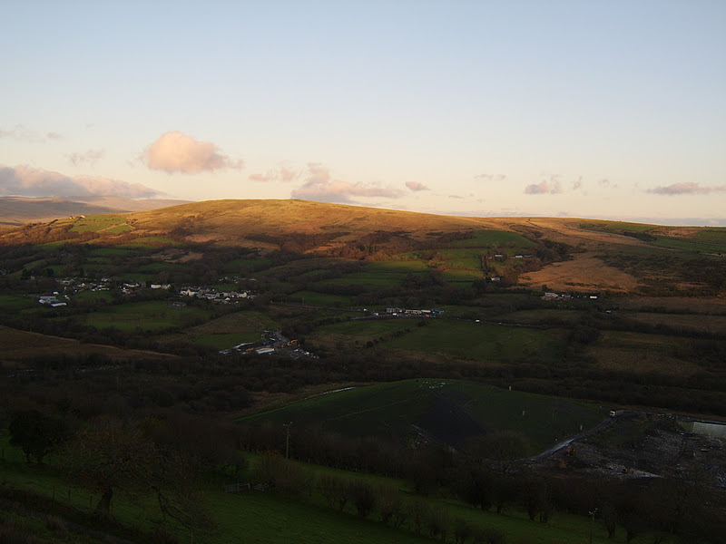
Looking Down Toward Cwmgors, the A474 Picket Base.

Cwmgors in Distance.

Picket Base, Windmill Masters Work Base and Turbine Road Under Construction, still some ways to go before it even reaches Nant y Melyn Farm, I doubt if the road will get through the Mountains this side of Xmas. If it snows bad, the gully road it intends to go throught will get blocked easy and thus delay construction time table. Lets hope we have heavy snows plus heavy rain as they have to divert a small river too en route, that will be difficult to do too, if flooding.

To Bottem right the Land Fill Site and Incinerator at Pwllwatkin, it's possible to access a road from A474 up to the lower area of Bryn Mawr. Other route is via road from Rhyd y Fro, again off A474 up towards Mynydd y Gwair, turn off towards Bryn Mawr and proceed to a very sharp elbow bend along this Mountain Road, a few cars may park here and then further access is along lane way past a farm on the right to the small open cast workings. There is also a trackway along bottem of Bryn Mawr, see photos below and consult web terrestial and sattilte maps
Looking down toward Pontardawe and Swansea, the Turbines will come this way from Swansea docks. long before then the entire route needs Road Side Placards and Poster Campaigning as at level achieved my MAP in Canol Cymru. C'mon some Grey Wolves get cracking!

Setting Up For A foto - looking North.

The Pass way under Bryn Mawr.

Interesting Shot - Marking Route To Follow.

Same (Ideal for a BBQ?).

Lane Below Bryn Mawr and Towards Track from Nant y Melyn Farm, through the gully towards small open cast and up on to Mynydd y Betws.

Same, cars should pass along here maybe?

Track Continues, easy to see on Sattilite Map.

See where it's heading to below.

The Track Above will end up at the small Open Cast but before then take you in direction of another track, the one from Nant y Melyn Farm to the Open Cast. It is lined by a row of trees on either side, I suspect planted here some time ago as barrier to snow blocking the gully as no doubt this is route onto Mynydd y Betws from this dorection for Cattle and Sheep. This can be the only route possible for Turbine road, so keep a regular eye on this as potential area in which to carry out Placard and poster work plus in time as and when needs be actual protest picketing.

This side of the gully is in West Glamorgan and a Neath - Port Talbot Council Area, so protests here, be responsibility of Morgannwg Patriots. Mynydd y Gwair is also in West Glamorgan but a Swansea Council area. Mynydd y Betws is in Sir Gar, it is they who enclosed the land for the Renewables Robber Barons, so much for that Counties Rebecca Tradition? As to which County/Local Government Area Bryn Mawr is in, needs checking.

Mountain Side Track Way under Bryn Mawr.

Same at Place WhereTrack Opens up into a Wide Area Suitable For Gathering, Rally or even a Summer Camp, kind of 'Occupy Bryn Mawr'.

Same, great views from here.

Passing on under Bryn Mawr.

This ViewTowards North East, up goes the posters and Baner Pitchfork.

In Back Ground Eastern Limits of Mynydd y Betws.

Same, note these Electricity Posts and Pylons contine over Mynydd y Betws and Mynydd y Gwair in area of the intended two Windmill Plantations.

Look Down into the Gully Between Bryn Mawr and East Mynydd y Betws and you will see a smal Open Cast, this to me appears that it blocks way of Turbine Road, check it out ok!

View towards the Parish of Llanwig and Eglwys Llanwig where Llywelyn Fawr forced Normans of Gwyr to leave the natives alone and pay homage to he, a Welsh Prince.

Posters, now you go out and stick some up all over the Two Mountains.

From this point the track gets broken up but not impassable, just difficult but continue and you will be well onto Mynydd Y Gwair and Mynydd y Betws, not yet worked out which way Turbine Road goes after it gets thru the gully. See maps below:
Trig pillar on Bryn Mawr:: OS grid SN6908 :: Geograph Britain and ...
www.geograph.org.uk/photo/149440
9 Apr 2006 – Trig pillar on Bryn Mawr. near to Cwmgors, Neath Port ... TIP: Click themap for Large scale mapping. Change to interactive Map > ...Map of Cwmgors, Carmarthenshire (Sir Gaerfyrddin), Mid Wales ...
www.linking-britain.net/town-cwmgors,42058/ - Translate this pageMap of Cwmgors Wales : Bringing together the community of Cwmgors through networking and maps : Linking Britain.
Other Information:
Pwllfawatkin landfill:: OS grid SN6908 :: Geograph Britain and ...
www.geograph.org.uk/photo/149444
9 Apr 2006 – ... controversial Pwllfa-watkin landfill site near Cwmgors as seen from the road down Bryn Mawr. ... TIP: Click the map for Large scale mapping ...Cwmgors and Gwaun-cae-gurwen, a genealogy help page
www.tytwp.plus.com/Waun/Waun.html
Click Diagram for a modern map. Acknowledgements .... There are many local GCG/Tairgwaith/Brynamman/Cwmgors photographs in this book. Railways at ...
GENUKI: Llangiwg
www.genuki.org.uk/big/wal/GLA/Llangiwg/
12 Nov 2009 – ... of this Parish, in 1801, (including the Hamlets Allt Grûg, and ParcelMawr) was 491. ... Maps Newspapers Occupations Population Public Records Schools... See the Cwmgors/Waun site for a database of local chapels and churches ... BrynSee Next Post P3 Mynydd Y Betws Campaign 2012 - 2013 and ref to Mynydd y Gwair Campaign.